 vesseltracker.com
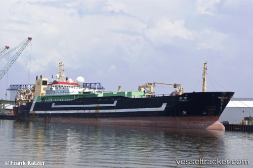
Vessel Tsaritsa IMO: 8707446, MMSI: 273426890 Fishing Vessel
UTC, 47.31500, 147.21333, course: -1, speed: 11
UTC, 47.11500, 146.76167, course: -1, speed: 11
2026-01-17 07:50:50 UTC, 47.11500, 146.76167, course: -1, speed: 11
Live AIS position:
UTC. 77 nm E of Launsdorf),
updated 2026-01-17 07:50:50 UTC.
Find the position of the vessel Tsaritsa on the map. The latter are known coordinates and path.
marine traffic ship tracker show on live map
The current position of vessel Tsaritsa is 47.11500 lat / 146.76167 lng. Updated: 2026-01-17 07:50:50 UTCCurrently sailing under the flag of Russia
Tsaritsa built in 1988 year
Deadweight:
3250 tDetails:
Last coordinates of the vessel:
UTC, 47.32167, 147.22501, course: -1, speed: 11UTC, 47.31500, 147.21333, course: -1, speed: 11
UTC, 47.11500, 146.76167, course: -1, speed: 11
2026-01-17 07:50:50 UTC, 47.11500, 146.76167, course: -1, speed: 11