 vesseltracker.com
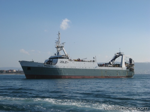
Vessel Robin M. Lee IMO: 8717465, MMSI: 740366000 Fishing Vessel
UTC, -16.65333, -37.66333, course: -1, speed: 13
UTC, -16.81500, -37.73667, course: -1, speed: 13
2026-01-19 18:58:53 UTC, -17.08575, -37.86205, course: 204, speed: 13.6
Live AIS position:
UTC. 81 nm E of Alcobaca),
updated 2026-01-19 18:58:53 UTC.
Find the position of the vessel Robin M. Lee on the map. The latter are known coordinates and path.
marine traffic ship tracker show on live map
The current position of vessel Robin M. Lee is -17.08575 lat / -37.86205 lng. Updated: 2026-01-19 18:58:53 UTCCurrently sailing under the flag of UK
Robin M. Lee built in 1989 year
Deadweight:
744 tDetails:
Last coordinates of the vessel:
UTC, -16.57833, -37.62833, course: -1, speed: 14UTC, -16.65333, -37.66333, course: -1, speed: 13
UTC, -16.81500, -37.73667, course: -1, speed: 13
2026-01-19 18:58:53 UTC, -17.08575, -37.86205, course: 204, speed: 13.6