vessel Mt Riah IMO: 8816455, Oil Products Tanker
vesseltracker.com
Vessel Mt Riah IMO: 8816455, Oil Products Tanker
MMSI: 354567000 callsign: HO6652 size: 160x68

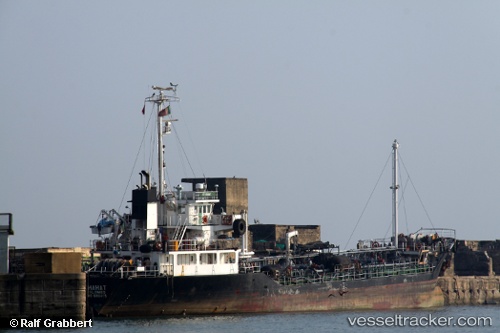
Find the position of the vessel Mt Riah on the map. The latter are known coordinates and path.

marine traffic ship tracker show on live map

The current position of vessel Mt Riah is 25.3619 lat / 55.3741 lng. Updated: 2024-07-04 08:33:35 UTC

Currently sailing under the flag of Panama

Mt Riah built in 1993 year

Deadweight:
23256 t

Payload_mass:
1899 tonne
Gross tonnage:
699
Service entry:
1988-01-01T00:00:00Z
Details:


Last coordinates of the vessel:
2024-07-04 08:33:35 UTC, 25.3619, 55.3741, course: 209, speed: 0


Most frequent ports a vessels calls at Mt Riah (354567000):

Sharjah, traffic: 9
Sambu, traffic: 8
Singapore, traffic: 4
Chittagong, traffic: 4
Bur Ibrahim, traffic: 2
Cape St. Jacques, traffic: 2
Vung Tau, traffic: 2
Derince, traffic: 2
Golcuk, traffic: 2
Kandla, traffic: 2
Mutrah, traffic: 1
Ras as Sidr, traffic: 1
Ra’S Shukhayr, traffic: 1
Gelibolu, traffic: 1

Link to the map:


Find another ship

Mt_Riah (354567000) last ports (portcalls and passsages)

Sharjah | 2024-01-09 21:38:49
Sharjah | 2024-01-05 20:56:08
Sharjah | 2024-01-01 19:41:42
Sharjah | 2023-12-28 19:24:17
Sharjah | 2023-12-24 17:39:23
Sharjah | 2023-12-20 17:00:47
Sharjah | 2023-12-16 16:38:15
Sharjah | 2023-12-12 15:48:25
Sharjah | 2023-12-08 14:21:14
Bur Ibrahim | 2022-11-04 14:26:24
Derince | 2022-10-06 10:15:56
Golcuk | 2022-10-02 07:36:04
Gelibolu | 2022-10-01 17:05:16
Bur Ibrahim | 2022-09-26 16:23:51
Ras as Sidr | 2022-09-25 23:04:34
Ra’S Shukhayr | 2022-09-25 13:54:03
Mutrah | 2022-03-30 05:58:41
Chittagong | 2022-02-18 09:00:17
Singapore | 2022-01-30 19:35:33
Cape St. Jacques | 2021-12-30 06:10:09
Sambu | 2021-12-28 04:30:08
Sambu | 2021-12-28 04:15:09
Sambu | 2021-12-28 04:00:08
Chittagong | 2021-12-21 07:50:09
Kandla | 2021-12-10 11:40:47