 vesseltracker.com
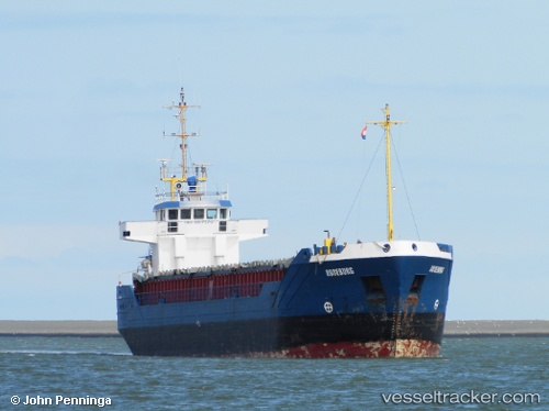
Vessel Roseburg IMO: 8817370, MMSI: 305184000 General Cargo Ship
UTC, 54.29539, 9.69214, course: 69, speed: 6.9
UTC, 54.36355, 9.85074, course: 95, speed: 6.8
2026-01-17 06:21:10 UTC, 54.36592, 10.13866, course: 104, speed: 1.4
Live AIS position:
UTC. Near Nord-Ostsee-Kanal),
updated 2026-01-17 06:21:10 UTC.
Find the position of the vessel Roseburg on the map. The latter are known coordinates and path.
marine traffic ship tracker show on live map
The current position of vessel Roseburg is 54.36592 lat / 10.13866 lng. Updated: 2026-01-17 06:21:10 UTCCurrently sailing under the flag of Antigua Barbuda
Roseburg built in 1991 year
Deadweight:
3005 tDetails:
Last coordinates of the vessel:
UTC, 54.20585, 9.56793, course: 50, speed: 7UTC, 54.29539, 9.69214, course: 69, speed: 6.9
UTC, 54.36355, 9.85074, course: 95, speed: 6.8
2026-01-17 06:21:10 UTC, 54.36592, 10.13866, course: 104, speed: 1.4