vessel HERCULES IMO: 8846187, Tug vesseltracker.com
Vessel HERCULES IMO: 8846187, Tug
MMSI: 367043330 callsign: WDE2549 size: 53x13

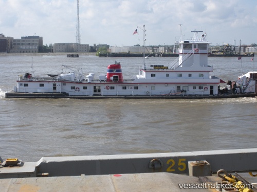
Find the position of the vessel HERCULES on the map. The latter are known coordinates and path.

marine traffic ship tracker show on live map

The current position of vessel HERCULES is 47.66375 lat / -122.39203 lng. Updated: 2025-06-07 02:57:45 UTC

Currently sailing under the flag of United States of America

HERCULES built in 1984 year

Deadweight:
0 t

Details:


Last coordinates of the vessel:
2025-06-07 02:57:45 UTC, 47.66375, -122.39203, course: 178, speed: 0


Most frequent ports a vessels calls at HERCULES (367043330):

Baton Rouge, traffic: 11
Burnside, traffic: 8
BAINBRIDGE ISLAND, traffic: 2
SHILSHOLE, traffic: 1
Good Hope, traffic: 1

Link to the map:


Find another ship

HERCULES (367043330) last ports (portcalls and passsages)

BAINBRIDGE ISLAND | 2025-06-06 03:29:32
SHILSHOLE | 2025-06-06 01:54:52
Baton Rouge | 2022-12-07 23:18:28
Burnside | 2022-12-05 17:08:07
Burnside | 2022-11-29 08:34:31
Baton Rouge | 2022-11-28 23:57:13
Baton Rouge | 2022-11-14 17:19:50
Burnside | 2022-11-09 02:56:42
Baton Rouge | 2022-11-08 17:21:45
Burnside | 2022-10-20 13:26:04
Baton Rouge | 2022-10-20 01:10:17
Baton Rouge | 2022-05-15 07:34:15
Good Hope | 2022-05-12 16:02:04
Burnside | 2022-05-11 10:22:33
Baton Rouge | 2022-05-10 22:07:03
Burnside | 2022-03-28 21:20:08
Baton Rouge | 2021-12-09 09:41:52
Burnside | 2021-12-05 21:20:02
Baton Rouge | 2021-12-04 20:45:04