 vesseltracker.com
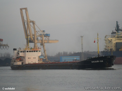
Vessel Omskiy 133 IMO: 8873336, MMSI: 273310900 General Cargo Ship
UTC, 36.80159, 34.65020, course: 269, speed: 0
UTC, 36.80159, 34.65019, course: 269, speed: 0
2026-01-17 05:27:25 UTC, 36.80160, 34.65020, course: 269, speed: 0
Live AIS position:
UTC. Near Mersin-Free Zone),
updated 2026-01-17 05:27:25 UTC.
Find the position of the vessel Omskiy 133 on the map. The latter are known coordinates and path.
marine traffic ship tracker show on live map
The current position of vessel Omskiy 133 is 36.80160 lat / 34.65020 lng. Updated: 2026-01-17 05:27:25 UTCCurrently sailing under the flag of Russia
Omskiy 133 built in 1988 year
Deadweight:
3070 tDetails:
Last coordinates of the vessel:
UTC, 36.80161, 34.65020, course: 269, speed: 0UTC, 36.80159, 34.65020, course: 269, speed: 0
UTC, 36.80159, 34.65019, course: 269, speed: 0
2026-01-17 05:27:25 UTC, 36.80160, 34.65020, course: 269, speed: 0