 vesseltracker.com
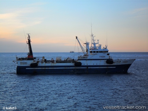
Vessel Granit IMO: 8901509, MMSI: 273440690 Fishing Vessel
UTC, 34.75820, 126.25570, course: 60, speed: 11.1
UTC, 34.77482, 126.40977, course: 170, speed: 0
2026-01-17 15:44:08 UTC, 34.77482, 126.40977, course: 170, speed: 0
Live AIS position:
UTC. Near Mogpo),
updated 2026-01-17 15:44:08 UTC.
Find the position of the vessel Granit on the map. The latter are known coordinates and path.
marine traffic ship tracker show on live map
The current position of vessel Granit is 34.77482 lat / 126.40977 lng. Updated: 2026-01-17 15:44:08 UTCDetails:
Last coordinates of the vessel:
UTC, 34.75820, 126.25570, course: 60, speed: 11.1UTC, 34.75820, 126.25570, course: 60, speed: 11.1
UTC, 34.77482, 126.40977, course: 170, speed: 0
2026-01-17 15:44:08 UTC, 34.77482, 126.40977, course: 170, speed: 0