 vesseltracker.com
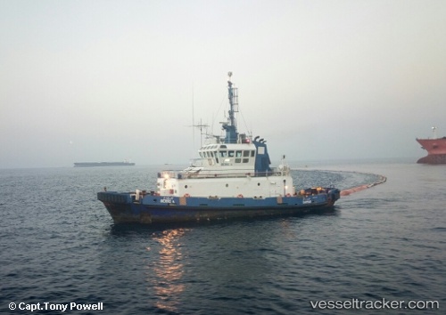
Vessel Berri 4 IMO: 8919740, MMSI: 403702610 Tug
UTC, 26.93164, 50.04098, course: -1, speed: 0.3
UTC, 26.93113, 50.04103, course: -1, speed: 0.9
2026-01-19 02:15:40 UTC, 26.93098, 50.03866, course: -1, speed: 0.2
Live AIS position:
UTC. 18 nm N of Ras Tannurah),
updated 2026-01-19 02:15:40 UTC.
Find the position of the vessel Berri 4 on the map. The latter are known coordinates and path.
marine traffic ship tracker show on live map
The current position of vessel Berri 4 is 26.93098 lat / 50.03866 lng. Updated: 2026-01-19 02:15:40 UTCDetails:
Last coordinates of the vessel:
UTC, 26.93217, 50.06227, course: -1, speed: 0.2UTC, 26.93164, 50.04098, course: -1, speed: 0.3
UTC, 26.93113, 50.04103, course: -1, speed: 0.9
2026-01-19 02:15:40 UTC, 26.93098, 50.03866, course: -1, speed: 0.2