 vesseltracker.com
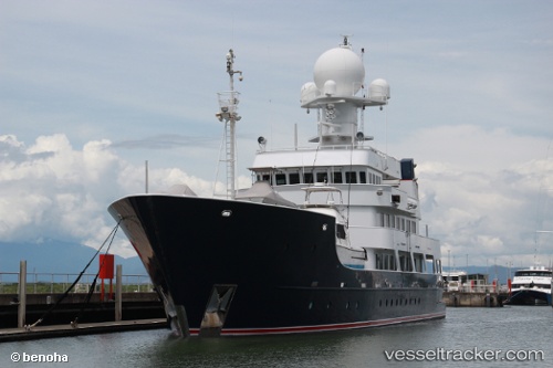
Vessel Pangaea Ocean Explor IMO: 8980282, MMSI: 339776000 Service Ship
UTC, -44.98312, 167.39278, course: 53, speed: 0.4
UTC, -44.98167, 167.39166, course: -1, speed: 0
2026-01-17 04:23:11 UTC, -44.98332, 167.39323, course: 356, speed: 0.3
Live AIS position:
UTC. 29 nm NE of Doubtful Sound),
updated 2026-01-17 04:23:11 UTC.
Find the position of the vessel Pangaea Ocean Explor on the map. The latter are known coordinates and path.
marine traffic ship tracker show on live map
The current position of vessel Pangaea Ocean Explor is -44.98332 lat / 167.39323 lng. Updated: 2026-01-17 04:23:11 UTCDetails:
Last coordinates of the vessel:
UTC, -44.75333, 167.42833, course: -1, speed: 10UTC, -44.98312, 167.39278, course: 53, speed: 0.4
UTC, -44.98167, 167.39166, course: -1, speed: 0
2026-01-17 04:23:11 UTC, -44.98332, 167.39323, course: 356, speed: 0.3