 vesseltracker.com
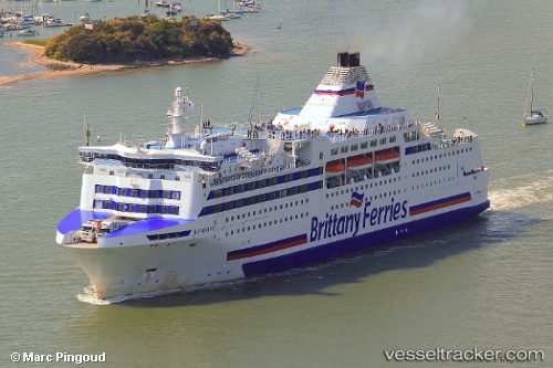
Find the position of the vessel Normandie on the map. The latter are known coordinates and path.
marine traffic ship tracker show on live map
The current position of vessel Normandie is 36.3539 lat / -2.7559 lng. Updated: 2025-07-26 01:11:50 UTCCurrently sailing under the flag of France
Normandie built in 1992 year
Deadweight:
5229 tDetails:
Last coordinates of the vessel:
UTC, 36.6192, -1.89655, course: 234, speed: 16.4UTC, 36.3883, -2.355, course: -1, speed: 16
UTC, 36.3755, -2.5866, course: 261, speed: 15.9
2025-07-26 01:11:50 UTC, 36.3539, -2.7559, course: 261, speed: 15.9