 vesseltracker.com
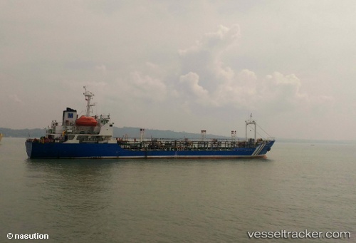
Vessel Mt.maxima Pratama IMO: 9012111, MMSI: 525014013 Chemical Tanker
UTC, -6.30323, 113.91466, course: -1, speed: 3.6
UTC, -6.30323, 113.91466, course: -1, speed: 3.6
2026-01-19 13:10:20 UTC, -6.30323, 113.91466, course: -1, speed: 3.6
Live AIS position:
UTC. 45 nm N of Sumenep),
updated 2026-01-19 13:10:20 UTC.
Find the position of the vessel Mt.maxima Pratama on the map. The latter are known coordinates and path.
marine traffic ship tracker show on live map
The current position of vessel Mt.maxima Pratama is -6.30323 lat / 113.91466 lng. Updated: 2026-01-19 13:10:20 UTCDetails:
Last coordinates of the vessel:
UTC, -6.30323, 113.91466, course: -1, speed: 3.6UTC, -6.30323, 113.91466, course: -1, speed: 3.6
UTC, -6.30323, 113.91466, course: -1, speed: 3.6
2026-01-19 13:10:20 UTC, -6.30323, 113.91466, course: -1, speed: 3.6