 vesseltracker.com
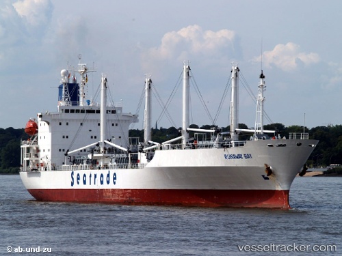
Vessel RUNAWAY BAY IMO: 9019640, MMSI: 311001116 Refrigerated Cargo Ship
UTC, -26.89055, -48.53416, course: 112, speed: 0.1
UTC, -26.89055, -48.53407, course: 108, speed: 0.1
2026-01-17 17:55:33 UTC, -26.89067, -48.53410, course: 105, speed: 0.1
Live AIS position:
UTC. Near NAVEGANTES),
updated 2026-01-17 17:55:33 UTC.
Find the position of the vessel RUNAWAY BAY on the map. The latter are known coordinates and path.
marine traffic ship tracker show on live map
The current position of vessel RUNAWAY BAY is -26.89067 lat / -48.53410 lng. Updated: 2026-01-17 17:55:33 UTCCurrently sailing under the flag of Bahamas
RUNAWAY BAY built in 1992 year
Deadweight:
11579 tDetails:
Last coordinates of the vessel:
UTC, -26.89133, -48.53208, course: 255, speed: 0.7UTC, -26.89055, -48.53416, course: 112, speed: 0.1
UTC, -26.89055, -48.53407, course: 108, speed: 0.1
2026-01-17 17:55:33 UTC, -26.89067, -48.53410, course: 105, speed: 0.1