 vesseltracker.com
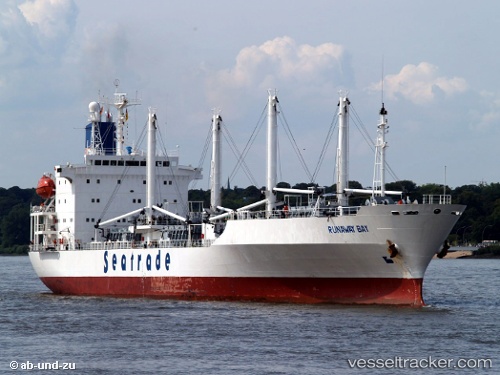
Find the position of the vessel RUNAWAY BAY on the map. The latter are known coordinates and path.
marine traffic ship tracker show on live map
The current position of vessel RUNAWAY BAY is 22.5635 lat / -57.6086 lng. Updated: 2025-07-16 07:18:01 UTCCurrently sailing under the flag of Bahamas
RUNAWAY BAY built in 1992 year
Deadweight:
11579 tDetails:
Last coordinates of the vessel:
UTC, 22.988, -58.0064, course: 137, speed: 9.3UTC, 22.8736, -57.8981, course: 138, speed: 9.1
UTC, 22.7797, -57.8066, course: 136, speed: 9.1
2025-07-16 07:18:01 UTC, 22.5635, -57.6086, course: 135, speed: 9.2