 vesseltracker.com
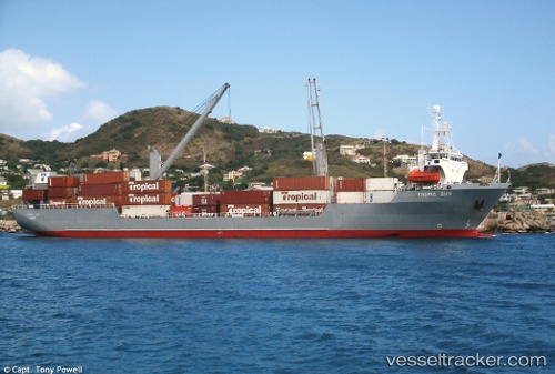
Vessel Tropic Sun IMO: 9039016, MMSI: 375902000 Ro Ro Cargo Ship
UTC, 18.31274, -64.93978, course: 99, speed: 0.1
UTC, 18.31240, -64.93998, course: 71, speed: 0.5
2026-01-17 18:48:39 UTC, 18.31258, -64.93989, course: 83, speed: 0.3
Live AIS position:
UTC. Near ST THOMAS),
updated 2026-01-17 18:48:39 UTC.
Find the position of the vessel Tropic Sun on the map. The latter are known coordinates and path.
marine traffic ship tracker show on live map
The current position of vessel Tropic Sun is 18.31258 lat / -64.93989 lng. Updated: 2026-01-17 18:48:39 UTCCurrently sailing under the flag of St Vincent Grenadines
Tropic Sun built in 1992 year
Deadweight:
7450 tDetails:
Last coordinates of the vessel:
UTC, 18.31269, -64.93982, course: 86, speed: 0.4UTC, 18.31274, -64.93978, course: 99, speed: 0.1
UTC, 18.31240, -64.93998, course: 71, speed: 0.5
2026-01-17 18:48:39 UTC, 18.31258, -64.93989, course: 83, speed: 0.3