 vesseltracker.com
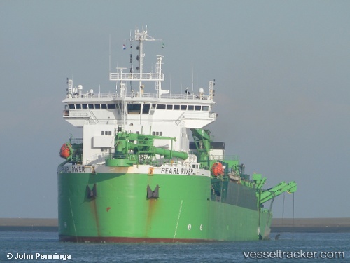
Vessel PEARL RIVER IMO: 9051014, MMSI: 210245000 Suction Dredger
UTC, 0.72075, 104.17601, course: 58, speed: 0
UTC, 0.72078, 104.17602, course: 68, speed: 0
2026-01-16 17:59:30 UTC, 0.72082, 104.17595, course: 78, speed: 0
Live AIS position:
UTC. 18 nm S of Lobam),
updated 2026-01-16 17:59:30 UTC.
Find the position of the vessel PEARL RIVER on the map. The latter are known coordinates and path.
marine traffic ship tracker show on live map
The current position of vessel PEARL RIVER is 0.72082 lat / 104.17595 lng. Updated: 2026-01-16 17:59:30 UTCCurrently sailing under the flag of Cyprus
PEARL RIVER built in 1994 year
Deadweight:
17947 tDetails:
Last coordinates of the vessel:
UTC, 0.72073, 104.17606, course: 48, speed: 0UTC, 0.72075, 104.17601, course: 58, speed: 0
UTC, 0.72078, 104.17602, course: 68, speed: 0
2026-01-16 17:59:30 UTC, 0.72082, 104.17595, course: 78, speed: 0