 vesseltracker.com
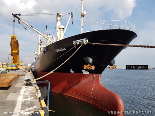
Vessel Hanglima IMO: 9074846, MMSI: 525003244 General Cargo Ship
UTC, -6.36680, 111.86543, course: -1, speed: 4.3
UTC, -6.36680, 111.86543, course: -1, speed: 4.3
2026-01-07 17:23:13 UTC, -6.36680, 111.86543, course: -1, speed: 4.3
Live AIS position:
UTC. 29 nm NW of Gagak Rimang Fso),
updated 2026-01-07 17:23:13 UTC.
Find the position of the vessel Hanglima on the map. The latter are known coordinates and path.
marine traffic ship tracker show on live map
The current position of vessel Hanglima is -6.36680 lat / 111.86543 lng. Updated: 2026-01-07 17:23:13 UTCCurrently sailing under the flag of Indonesia
Hanglima built in 1993 year
Deadweight:
5318 tDetails:
Last coordinates of the vessel:
UTC, -6.36680, 111.86543, course: -1, speed: 4.3UTC, -6.36680, 111.86543, course: -1, speed: 4.3
UTC, -6.36680, 111.86543, course: -1, speed: 4.3
2026-01-07 17:23:13 UTC, -6.36680, 111.86543, course: -1, speed: 4.3