 vesseltracker.com
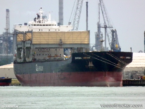
Vessel Grebe Arrow IMO: 9077070, MMSI: 309759000 Multi Purpose Carrier
UTC, 31.99930, 120.82555, course: 315, speed: 0
UTC, 31.99930, 120.82555, course: 315, speed: 0
2026-02-12 22:25:44 UTC, 31.99928, 120.82552, course: 315, speed: 0
Live AIS position:
UTC. Near Nantong),
updated 2026-02-12 22:25:44 UTC.
Find the position of the vessel Grebe Arrow on the map. The latter are known coordinates and path.
marine traffic ship tracker show on live map
The current position of vessel Grebe Arrow is 31.99928 lat / 120.82552 lng. Updated: 2026-02-12 22:25:44 UTCCurrently sailing under the flag of Bahamas
Grebe Arrow built in 1997 year
Deadweight:
55671 tDetails:
Last coordinates of the vessel:
UTC, 31.99928, 120.82555, course: 315, speed: 0UTC, 31.99930, 120.82555, course: 315, speed: 0
UTC, 31.99930, 120.82555, course: 315, speed: 0
2026-02-12 22:25:44 UTC, 31.99928, 120.82552, course: 315, speed: 0