 vesseltracker.com
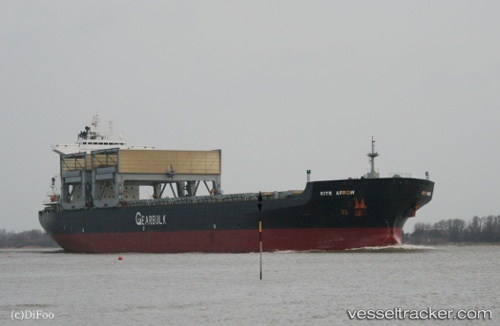
Vessel Kite Arrow IMO: 9077082, MMSI: 309764000 Multi Purpose Carrier
UTC, -45.03167, 164.91499, course: -1, speed: 13
UTC, -45.01020, 164.89622, course: 333, speed: 13
2026-01-17 04:24:06 UTC, -44.67031, 164.62444, course: 332, speed: 12.6
Live AIS position:
UTC. 101 nm W of Doubtful Sound),
updated 2026-01-17 04:24:06 UTC.
Find the position of the vessel Kite Arrow on the map. The latter are known coordinates and path.
marine traffic ship tracker show on live map
The current position of vessel Kite Arrow is -44.67031 lat / 164.62444 lng. Updated: 2026-01-17 04:24:06 UTCDetails:
Last coordinates of the vessel:
UTC, -45.47498, 165.33572, course: 326, speed: 12.8UTC, -45.03167, 164.91499, course: -1, speed: 13
UTC, -45.01020, 164.89622, course: 333, speed: 13
2026-01-17 04:24:06 UTC, -44.67031, 164.62444, course: 332, speed: 12.6