 vesseltracker.com
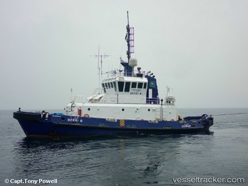
Vessel Berri 6 IMO: 9079341, MMSI: 403710710 Tug
UTC, 26.94075, 50.03691, course: -1, speed: 1
UTC, 26.94056, 50.03664, course: -1, speed: 0.4
2026-01-17 12:27:30 UTC, 26.94054, 50.03644, course: -1, speed: 0.6
Live AIS position:
UTC. 19 nm E of Al Jubayl),
updated 2026-01-17 12:27:30 UTC.
Find the position of the vessel Berri 6 on the map. The latter are known coordinates and path.
marine traffic ship tracker show on live map
The current position of vessel Berri 6 is 26.94054 lat / 50.03644 lng. Updated: 2026-01-17 12:27:30 UTCDetails:
Last coordinates of the vessel:
UTC, 26.94067, 50.03686, course: -1, speed: 0.6UTC, 26.94075, 50.03691, course: -1, speed: 1
UTC, 26.94056, 50.03664, course: -1, speed: 0.4
2026-01-17 12:27:30 UTC, 26.94054, 50.03644, course: -1, speed: 0.6