 vesseltracker.com
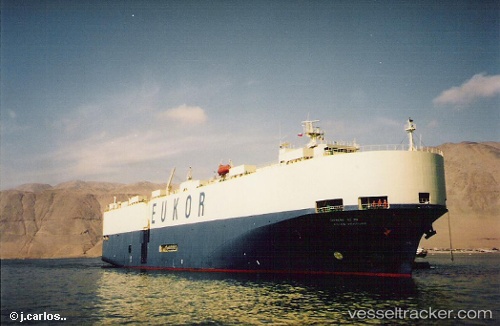
Find the position of the vessel Glovis Prime on the map. The latter are known coordinates and path.
marine traffic ship tracker show on live map
The current position of vessel Glovis Prime is 22.217 lat / 68.6982 lng. Updated: 2025-06-06 22:25:57 UTCPayload_mass:
13241 tonneGross tonnage:
44891Service entry:
1995-01-01T00:00:00ZManufacturer:
HD Hyundai Mipo (South Korean shipbuilding company)Details:
Last coordinates of the vessel:
UTC, 22.2144, 68.697, course: 318, speed: 0UTC, 22.2144, 68.6971, course: 317, speed: 0
UTC, 22.2154, 68.6982, course: 298, speed: 0.1
2025-06-06 22:25:57 UTC, 22.217, 68.6982, course: 247, speed: 0