 vesseltracker.com
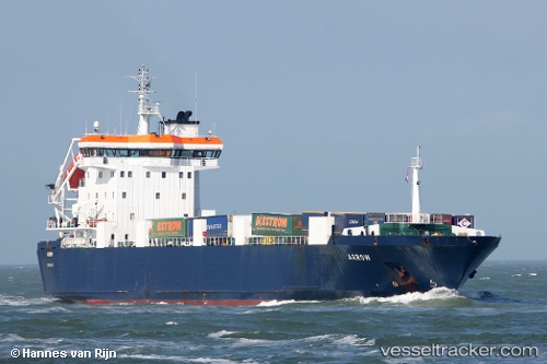
Vessel Arrow IMO: 9119414, MMSI: 235096892 Ro Ro Cargo Ship
UTC, 51.04111, 2.35811, course: 38, speed: 0
UTC, 51.04112, 2.35820, course: 38, speed: 0
2026-01-18 18:31:14 UTC, 51.04108, 2.35820, course: 38, speed: 0
Live AIS position:
UTC. Near Saint-Pol-sur-Mer),
updated 2026-01-18 18:31:14 UTC.
Find the position of the vessel Arrow on the map. The latter are known coordinates and path.
marine traffic ship tracker show on live map
The current position of vessel Arrow is 51.04108 lat / 2.35820 lng. Updated: 2026-01-18 18:31:14 UTCCurrently sailing under the flag of United Kingdom
Arrow built in 1998 year
Deadweight:
5656 tDetails:
Last coordinates of the vessel:
UTC, 51.04110, 2.35819, course: 38, speed: 0UTC, 51.04111, 2.35811, course: 38, speed: 0
UTC, 51.04112, 2.35820, course: 38, speed: 0
2026-01-18 18:31:14 UTC, 51.04108, 2.35820, course: 38, speed: 0