 vesseltracker.com
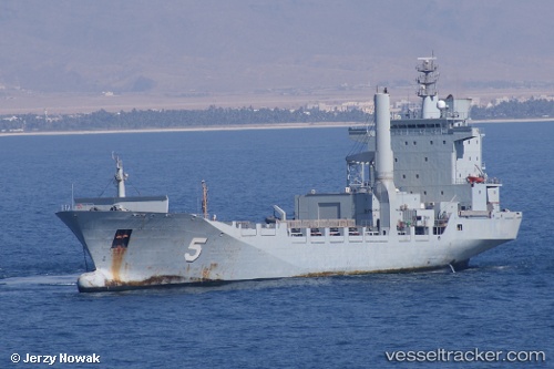
Find the position of the vessel Ka Bunga Mas 5 on the map. The latter are known coordinates and path.
marine traffic ship tracker show on live map
The current position of vessel Ka Bunga Mas 5 is 6.0857283333333 lat / 116.11427 lng. Updated: 2025-10-05 23:16:36 UTCCurrently sailing under the flag of Malaysia
Ka Bunga Mas 5 built in 1997 year
Deadweight:
8991 tDetails:
Last coordinates of the vessel:
UTC, 6.0857166666667, 116.11422166667, course: -1, speed: 0UTC, 6.085725, 116.11424833333, course: -1, speed: 0
UTC, 6.0857383333333, 116.11427, course: -1, speed: 0
2025-10-05 23:16:36 UTC, 6.0857283333333, 116.11427, course: -1, speed: 0