 vesseltracker.com
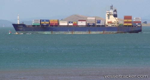
Vessel Msc Imma IMO: 9124366, MMSI: 355714000 Container Ship
UTC, 4.89290, -1.74285, course: 76, speed: 0
UTC, 4.89292, -1.74286, course: 75, speed: 0
2026-01-18 14:02:04 UTC, 4.89290, -1.74285, course: 75, speed: 0
Live AIS position:
UTC. Near Takoradi),
updated 2026-01-18 14:02:04 UTC.
Find the position of the vessel Msc Imma on the map. The latter are known coordinates and path.
marine traffic ship tracker show on live map
The current position of vessel Msc Imma is 4.89290 lat / -1.74285 lng. Updated: 2026-01-18 14:02:04 UTCCurrently sailing under the flag of Panama
Msc Imma built in 1996 year
Deadweight:
35980 tDetails:
Last coordinates of the vessel:
UTC, 4.89288, -1.74285, course: 77, speed: 0UTC, 4.89290, -1.74285, course: 76, speed: 0
UTC, 4.89292, -1.74286, course: 75, speed: 0
2026-01-18 14:02:04 UTC, 4.89290, -1.74285, course: 75, speed: 0