 vesseltracker.com
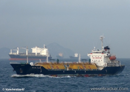
Vessel Runfar IMO: 9140592, MMSI: 356064000 Lpg Tanker
UTC, 40.96559, 28.77467, course: 214, speed: 0.1
UTC, 40.96552, 28.77460, course: 228, speed: 0.4
2026-01-15 08:59:11 UTC, 40.96587, 28.77475, course: 217, speed: 0.1
Live AIS position:
UTC. Near Küçükçekmece),
updated 2026-01-15 08:59:11 UTC.
Find the position of the vessel Runfar on the map. The latter are known coordinates and path.
marine traffic ship tracker show on live map
The current position of vessel Runfar is 40.96587 lat / 28.77475 lng. Updated: 2026-01-15 08:59:11 UTCDetails:
Last coordinates of the vessel:
UTC, 40.96568, 28.77431, course: 196, speed: 0.1UTC, 40.96559, 28.77467, course: 214, speed: 0.1
UTC, 40.96552, 28.77460, course: 228, speed: 0.4
2026-01-15 08:59:11 UTC, 40.96587, 28.77475, course: 217, speed: 0.1