 vesseltracker.com
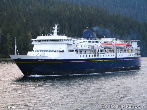
Vessel Kennicott IMO: 9145205, MMSI: 368250000 Passenger Ro Ro Cargo Ship
UTC, 54.48047, -131.05161, course: 195, speed: 15.6
UTC, 53.94951, -130.96754, course: 172, speed: 6.3
2026-01-15 07:45:11 UTC, 53.72038, -130.57486, course: 131, speed: 16.4
Live AIS position:
UTC. 32 nm S of Watson Island),
updated 2026-01-15 07:45:11 UTC.
Find the position of the vessel Kennicott on the map. The latter are known coordinates and path.
marine traffic ship tracker show on live map
The current position of vessel Kennicott is 53.72038 lat / -130.57486 lng. Updated: 2026-01-15 07:45:11 UTCDetails:
Last coordinates of the vessel:
UTC, 54.90078, -131.08786, course: 174, speed: 16.4UTC, 54.48047, -131.05161, course: 195, speed: 15.6
UTC, 53.94951, -130.96754, course: 172, speed: 6.3
2026-01-15 07:45:11 UTC, 53.72038, -130.57486, course: 131, speed: 16.4