 vesseltracker.com
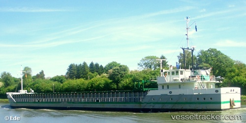
Vessel Ebenezer IMO: 9148439, MMSI: 503000370 General Cargo Ship
UTC, -43.09151, 147.30170, course: 97, speed: 0
UTC, -43.09151, 147.30170, course: 99, speed: 0
2026-01-19 01:09:27 UTC, -43.10963, 147.28902, course: 0, speed: 0
Live AIS position:
UTC. Near BLUNY ISLAND),
updated 2026-01-19 01:09:27 UTC.
Find the position of the vessel Ebenezer on the map. The latter are known coordinates and path.
marine traffic ship tracker show on live map
The current position of vessel Ebenezer is -43.10963 lat / 147.28902 lng. Updated: 2026-01-19 01:09:27 UTCCurrently sailing under the flag of Australia
Ebenezer built in 1996 year
Deadweight:
1000 tDetails:
Last coordinates of the vessel:
UTC, -43.03745, 147.27763, course: 191, speed: 0UTC, -43.09151, 147.30170, course: 97, speed: 0
UTC, -43.09151, 147.30170, course: 99, speed: 0
2026-01-19 01:09:27 UTC, -43.10963, 147.28902, course: 0, speed: 0