.
vessel 312576000 IMO: 9151333, vesseltracker.com
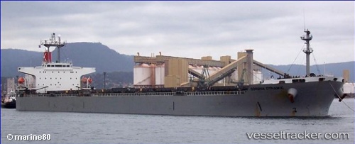
Vessel 312576000 IMO: 9151333, MMSI: 312576000

callsign:
size: x

Live AIS position: UTC. 20 nm SE of SHINAS), updated 2026-01-17 01:47:54 UTC.

Find the position of the vessel 312576000 on the map. The latter are known coordinates and path.

marine traffic ship tracker show on live map

The current position of vessel 312576000 is 24.61516 lat / 56.80178 lng. Updated: 2026-01-17 01:47:54 UTC
Details:


Last coordinates of the vessel:
UTC, 24.61500, 56.80167, course: -1, speed: 0
UTC, 24.61521, 56.80180, course: 169, speed: 0
2026-01-17 01:47:54 UTC, 24.61516, 56.80178, course: 169, speed: 0


Most frequent ports a vessels calls at 312576000 (312576000):

Iskenderun, traffic: 5
Rio Grande, traffic: 2
Santos, traffic: 2
Mina Abd Allah, traffic: 2
Bur Ibrahim, traffic: 1
Port Said, traffic: 1
Ras Gharib, traffic: 1

Link to the map:


Find another ship

312576000 (312576000) last ports (portcalls and passsages)

Ras Gharib | 2023-12-30 04:26:26
Bur Ibrahim | 2023-12-29 19:49:02
Port Said | 2023-12-29 01:14:38
Iskenderun | 2023-12-24 15:48:00
Iskenderun | 2023-12-20 15:00:41
Iskenderun | 2023-12-16 14:43:01
Iskenderun | 2023-12-12 14:05:44
Iskenderun | 2023-12-08 13:52:25
Sao Francisco Do Sul | 2022-12-07 02:58:05
Sao Francisco Do Sul | 2022-12-03 02:16:38
Sao Francisco Do Sul | 2022-11-28 23:44:43
Sao Francisco Do Sul | 2022-11-24 20:49:09
Mina Abd Allah | 2022-08-25 22:54:35
Mina Abd Allah | 2022-08-20 16:15:10
Santos | 2022-06-24 07:31:21
Santos | 2022-06-18 05:07:01
Rio Grande | 2022-05-28 19:39:33
Rio Grande | 2022-05-24 19:15:43
Sao Francisco Do Sul | 2022-05-19 05:06:22
Sao Francisco Do Sul | 2022-05-15 04:57:05