 vesseltracker.com
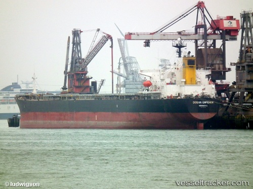
Vessel Ocean Emperor IMO: 9153795, MMSI: 636013281 Bulk Carrier
UTC, -34.75468, 18.29045, course: 282, speed: 11.4
UTC, -34.58003, 17.90331, course: 294, speed: 10.8
2026-01-17 20:32:17 UTC, -34.56497, 17.87308, course: 292, speed: 10.7
Live AIS position:
UTC. 28 nm SW of Cape Of Good Hope),
updated 2026-01-17 20:32:17 UTC.
Find the position of the vessel Ocean Emperor on the map. The latter are known coordinates and path.
marine traffic ship tracker show on live map
The current position of vessel Ocean Emperor is -34.56497 lat / 17.87308 lng. Updated: 2026-01-17 20:32:17 UTCCurrently sailing under the flag of Liberia
Ocean Emperor built in 1998 year
Deadweight:
74002 tDetails:
Last coordinates of the vessel:
UTC, -34.77399, 18.35214, course: 276, speed: 11.1UTC, -34.75468, 18.29045, course: 282, speed: 11.4
UTC, -34.58003, 17.90331, course: 294, speed: 10.8
2026-01-17 20:32:17 UTC, -34.56497, 17.87308, course: 292, speed: 10.7