 vesseltracker.com
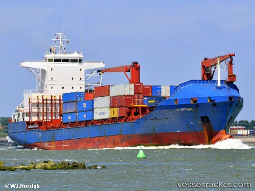
Vessel Setuba IMO: 9157131, MMSI: 351737000 Container Ship
UTC, 22.64305, 122.32273, course: 5, speed: 11.6
UTC, 22.88333, 122.35167, course: -1, speed: 11
2026-01-17 06:29:54 UTC, 23.05411, 122.37596, course: 359, speed: 11.4
Live AIS position:
UTC. 69 nm SE of Hua-Lien Kang),
updated 2026-01-17 06:29:54 UTC.
Find the position of the vessel Setuba on the map. The latter are known coordinates and path.
marine traffic ship tracker show on live map
The current position of vessel Setuba is 23.05411 lat / 122.37596 lng. Updated: 2026-01-17 06:29:54 UTCCurrently sailing under the flag of Panama
Setuba built in 1997 year
Deadweight:
16727 tDetails:
Last coordinates of the vessel:
UTC, 22.42500, 122.31167, course: -1, speed: 12UTC, 22.64305, 122.32273, course: 5, speed: 11.6
UTC, 22.88333, 122.35167, course: -1, speed: 11
2026-01-17 06:29:54 UTC, 23.05411, 122.37596, course: 359, speed: 11.4