 vesseltracker.com
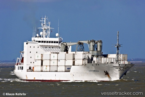
Vessel Baltic Lady IMO: 9160736, MMSI: 311001035 Refrigerated Cargo Ship
UTC, 28.02751, -51.42377, course: 61, speed: 16.3
UTC, 28.17751, -51.14051, course: 62, speed: 16.1
2026-01-16 19:55:04 UTC, 28.39999, -50.71264, course: 63, speed: 15.8
Live AIS position:
UTC. Open sea, approx. 412 nm off the nearest listed port),
updated 2026-01-16 19:55:04 UTC.
Find the position of the vessel Baltic Lady on the map. The latter are known coordinates and path.
marine traffic ship tracker show on live map
The current position of vessel Baltic Lady is 28.39999 lat / -50.71264 lng. Updated: 2026-01-16 19:55:04 UTCCurrently sailing under the flag of Bahamas
Details:
Last coordinates of the vessel:
UTC, 27.90834, -51.64943, course: 63, speed: 15.7UTC, 28.02751, -51.42377, course: 61, speed: 16.3
UTC, 28.17751, -51.14051, course: 62, speed: 16.1
2026-01-16 19:55:04 UTC, 28.39999, -50.71264, course: 63, speed: 15.8