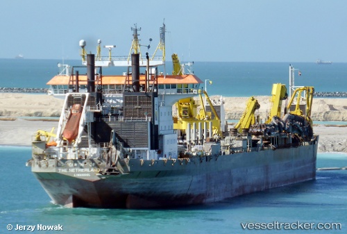
vessel Queen Of Netherlands IMO: 9164031, Hopper Dredger
Vessel Queen Of Netherlands IMO: 9164031, Hopper Dredger
MMSI: 210138000 callsign: 5BGT2 size: 32x230

Find the position of the vessel Queen Of Netherlands on the map. The latter are known coordinates and path.

marine traffic ship tracker show on live map

The current position of vessel Queen Of Netherlands is 24.6987 lat / 54.4905 lng. Updated: 2024-11-25 15:07:32 UTC
Port of registry:
Limassol (city in the Limassol District, Cyprus)
Speed:
18 knot
Gross tonnage:
33423
Beam:
32 metre
Service entry:
1998-01-01T00:00:00Z

Owned:
Royal Boskalis Westminster (Dutch dredging and heavylift company)

Details:


Last coordinates of the vessel:
UTC, 24.8893, 54.3828, course: 174, speed: 0.9
UTC, 24.8101, 54.4516, course: 204, speed: 11.3
UTC, 24.6988, 54.4904, course: 177, speed: 0
2024-11-25 15:07:32 UTC, 24.6987, 54.4905, course: 176, speed: 0


Most frequent ports a vessels calls at Queen Of Netherlands (210138000):

Olongapo, traffic: 4
Manila, traffic: 2
Mina Saqr, traffic: 2
Sambu, traffic: 2
KHALIFA, traffic: 2
Singapore, traffic: 1
Subic Bay, traffic: 1

Link to the map:


Find another ship

Queen_Of_Netherlands (210138000) last ports (portcalls and passsages)

KHALIFA | 2024-11-22 11:53:48
KHALIFA | 2024-11-18 11:28:45
Mina Saqr | 2024-06-12 23:47:32
Mina Saqr | 2024-06-08 23:32:22
Sambu | 2024-05-24 03:58:50
Singapore | 2023-11-20 19:48:58
Sambu | 2023-11-20 19:20:18
Manila | 2022-10-11 16:04:45
Olongapo | 2022-10-08 16:42:16
Olongapo | 2022-10-04 16:19:31
Olongapo | 2022-09-30 13:52:20
Olongapo | 2022-09-26 10:57:25
Subic Bay | 2022-09-26 04:37:20
Manila | 2021-12-15 03:05:00