vessel GOLROO IMO: 9167148, Crude Oil Tanker
Vessel GOLROO IMO: 9167148, Crude Oil Tanker
MMSI: 422489500 callsign: EPVI3 size: x

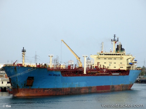
Find the position of the vessel GOLROO on the map. The latter are known coordinates and path.

marine traffic ship tracker show on live map

The current position of vessel GOLROO is 31.6174 lat / 32.3705 lng. Updated: 2024-09-24 13:23:29 UTC

Currently sailing under the flag of Iran

GOLROO built in 1999 year

Port of registry:
Piraeus (city and port of Attica region, Greece)
Deadweight:
34987 t

Gross tonnage:
22181
Service entry:
1999-01-01T00:00:00Z

Manufacturer:
Guangzhou Shipyard International (Chinese shipbuilding company)
Details:


Last coordinates of the vessel:
UTC, 31.6176, 32.3706, course: -1, speed: 0
UTC, 31.6175, 32.3706, course: -1, speed: 0.1
UTC, 31.6175, 32.3704, course: -1, speed: 0.1
2024-09-24 13:23:29 UTC, 31.6174, 32.3705, course: -1, speed: 0.1


Most frequent ports a vessels calls at GOLROO (422489500):

Bur Ibrahim, traffic: 8
Ra’S Shukhayr, traffic: 4
Port Said, traffic: 3
Ras Gharib, traffic: 1

Link to the map:


Find another ship

GOLROO (422489500) last ports (portcalls and passsages)

Bur Ibrahim | 2022-12-01 20:55:54
Port Said | 2022-12-01 02:07:50
Bur Ibrahim | 2022-11-16 11:57:55
Ras Gharib | 2022-10-10 04:54:25
Bur Ibrahim | 2022-10-09 16:45:12
Port Said | 2022-09-18 19:36:49
Bur Ibrahim | 2022-09-17 07:26:46
Ra’S Shukhayr | 2022-07-01 07:09:03
Bur Ibrahim | 2022-06-30 19:10:51
Bur Ibrahim | 2022-06-12 01:06:00
Ra’S Shukhayr | 2022-06-11 10:48:18
Port Said | 2021-12-26 21:45:06
Bur Ibrahim | 2021-12-25 08:35:20
Ra’S Shukhayr | 2021-12-24 14:33:45