 vesseltracker.com
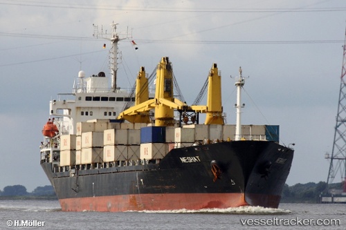
Vessel Neshat IMO: 9167277, MMSI: 422035800 General Cargo Ship
UTC, 24.99597, 55.06554, course: 227, speed: 0
UTC, 24.99600, 55.06557, course: 227, speed: 0
2026-01-17 09:26:18 UTC, 24.99595, 55.06551, course: 228, speed: 0
Live AIS position:
UTC. Near Jebel Ali Free Zone),
updated 2026-01-17 09:26:18 UTC.
Find the position of the vessel Neshat on the map. The latter are known coordinates and path.
marine traffic ship tracker show on live map
The current position of vessel Neshat is 24.99595 lat / 55.06551 lng. Updated: 2026-01-17 09:26:18 UTCCurrently sailing under the flag of Iran
Neshat built in 1999 year
Deadweight:
23116 tDetails:
Last coordinates of the vessel:
UTC, 24.99596, 55.06553, course: 227, speed: 0UTC, 24.99597, 55.06554, course: 227, speed: 0
UTC, 24.99600, 55.06557, course: 227, speed: 0
2026-01-17 09:26:18 UTC, 24.99595, 55.06551, course: 228, speed: 0