.
vessel ZAMBRA IMO: 9175078, Crude Oil Tanker vesseltracker.com
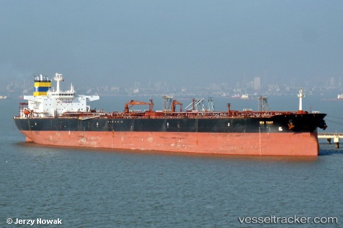
Vessel ZAMBRA IMO: 9175078, MMSI: 352001034 Crude Oil Tanker

callsign: 3FXA2
size: 274x274

Live AIS position: UTC. 21 nm S of Taman'), updated 2025-08-18 13:50:05 UTC.

Find the position of the vessel ZAMBRA on the map. The latter are known coordinates and path.

marine traffic ship tracker show on live map

The current position of vessel ZAMBRA is 44.88049 lat / 36.60262 lng. Updated: 2025-08-18 13:50:05 UTC

Currently sailing under the flag of Panama

ZAMBRA built in 1999 year

Deadweight:
157327 t

Details:


Last coordinates of the vessel:
2025-08-18 13:50:05 UTC, 44.88049, 36.60262, course: -1, speed: 1.9


Most frequent ports a vessels calls at ZAMBRA (352001034):

Samsun, traffic: 3
Kerch, traffic: 1
Ta-Ku, traffic: 1
Uskudar, traffic: 1
Taicang, traffic: 1
Jingjiang, traffic: 1
Canakkale, traffic: 1
Marmara Island , traffic: 1
Dagu, traffic: 1
LANSHAN, traffic: 1
Gelibolu, traffic: 1
KOMYSH BURUNSKA, traffic: 1
Istanbul, traffic: 1
Kao-Hsiung Kang, traffic: 1

Link to the map:


Find another ship

ZAMBRA (352001034) last ports (portcalls and passsages)

KOMYSH BURUNSKA | 2025-06-11 16:16:42
Samsun | 2025-05-10 04:17:29
LANSHAN | 2025-04-25 04:23:17
Samsun | 2025-02-10 09:47:45
Taicang | 2024-12-10 10:51:44
Ta-Ku | 2024-11-29 06:25:16
Uskudar | 2024-10-23 08:58:06
Marmara Island | 2024-10-22 14:11:53
Gelibolu | 2024-10-22 09:11:11
Canakkale | 2024-10-22 06:50:28
Jingjiang | 2024-04-01 05:07:17
Kao-Hsiung Kang | 2022-04-04 05:56:12