.
vessel 'CAPE STEFANIE' IMO: 9176113, vesseltracker.com
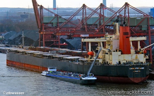
Vessel 'CAPE STEFANIE' IMO: 9176113, MMSI: 636019925

callsign:
size: x

Live AIS position: UTC. 33 nm SW of Mabruk), updated 2025-10-30 08:45:45 UTC.

Find the position of the vessel 'CAPE STEFANIE' on the map. The latter are known coordinates and path.

marine traffic ship tracker show on live map

The current position of vessel 'CAPE STEFANIE' is 29.73550 lat / 16.70296 lng. Updated: 2025-10-30 08:45:45 UTC
Details:


Last coordinates of the vessel:
2025-10-30 08:45:45 UTC, 29.73550, 16.70296, course: 127, speed: 5.8

Track of the vessel in the last 28 days


Most frequent ports a vessels calls at 'CAPE STEFANIE' (636019925):

Paradip, traffic: 19
Mangalore, traffic: 14
Panamburu, traffic: 6
Richards Bay, traffic: 4

Link to the map:


Find another ship

'CAPE_STEFANIE' (636019925) last ports (portcalls and passsages)

Paradip | 2022-12-02 23:35:48
Paradip | 2022-11-22 08:35:40
Paradip | 2022-10-31 11:29:01
Paradip | 2022-10-16 04:55:32
Paradip | 2022-10-02 19:40:06
Paradip | 2022-09-17 16:38:25
Paradip | 2022-09-04 02:19:06
Paradip | 2022-08-31 01:39:21
Paradip | 2022-08-15 07:35:45
Paradip | 2022-07-28 07:55:42
Paradip | 2022-07-09 22:24:55
Paradip | 2022-07-05 22:12:09
Paradip | 2022-06-21 16:38:54
Paradip | 2022-06-17 13:37:40
Paradip | 2022-06-01 07:06:04
Paradip | 2022-05-20 10:25:29
Paradip | 2022-05-16 10:20:37
Paradip | 2022-05-04 04:02:14
Paradip | 2022-03-07 08:45:56
Richards Bay | 2022-01-11 20:35:54
Mangalore | 2021-12-29 05:50:04
Mangalore | 2021-12-29 05:45:02
Panamburu | 2021-12-29 05:40:03
Panamburu | 2021-12-26 01:50:01
Panamburu | 2021-12-26 01:45:10
Mangalore | 2021-12-26 01:40:01
Richards Bay | 2021-12-04 05:50:30