 vesseltracker.com
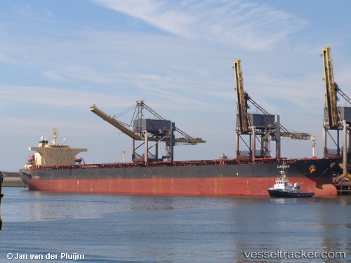
Vessel GINGO IMO: 9182710, MMSI: 636022145 Bulk Carrier
UTC, -4.38846, -34.47956, course: 124, speed: 10
UTC, -4.48952, -34.33633, course: 121, speed: 10
2026-01-18 11:31:39 UTC, -4.67338, -34.04391, course: 121, speed: 10
Live AIS position:
UTC. 94 nm NE of Natal),
updated 2026-01-18 11:31:39 UTC.
Find the position of the vessel GINGO on the map. The latter are known coordinates and path.
marine traffic ship tracker show on live map
The current position of vessel GINGO is -4.67338 lat / -34.04391 lng. Updated: 2026-01-18 11:31:39 UTCCurrently sailing under the flag of Liberia
GINGO built in 2000 year
Deadweight:
169159 tDetails:
Last coordinates of the vessel:
UTC, -4.36177, -34.51629, course: 124, speed: 9.9UTC, -4.38846, -34.47956, course: 124, speed: 10
UTC, -4.48952, -34.33633, course: 121, speed: 10
2026-01-18 11:31:39 UTC, -4.67338, -34.04391, course: 121, speed: 10