 vesseltracker.com
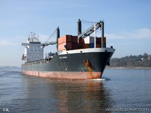
Vessel MERATUS SORONG IMO: 9186754, MMSI: 525125034 General Cargo Ship
UTC, -6.06950, 111.30210, course: 297, speed: 11.8
UTC, -6.06950, 111.30210, course: 297, speed: 11.8
2026-01-18 15:02:43 UTC, -6.06950, 111.30210, course: 297, speed: 11.8
Live AIS position:
UTC. 41 nm NE of TANJUNG JATI),
updated 2026-01-18 15:02:43 UTC.
Find the position of the vessel MERATUS SORONG on the map. The latter are known coordinates and path.
marine traffic ship tracker show on live map
The current position of vessel MERATUS SORONG is -6.06950 lat / 111.30210 lng. Updated: 2026-01-18 15:02:43 UTCCurrently sailing under the flag of Indonesia
MERATUS SORONG built in 1999 year
Deadweight:
20501 tDetails:
Last coordinates of the vessel:
UTC, -6.06950, 111.30210, course: 297, speed: 11.8UTC, -6.06950, 111.30210, course: 297, speed: 11.8
UTC, -6.06950, 111.30210, course: 297, speed: 11.8
2026-01-18 15:02:43 UTC, -6.06950, 111.30210, course: 297, speed: 11.8