 vesseltracker.com
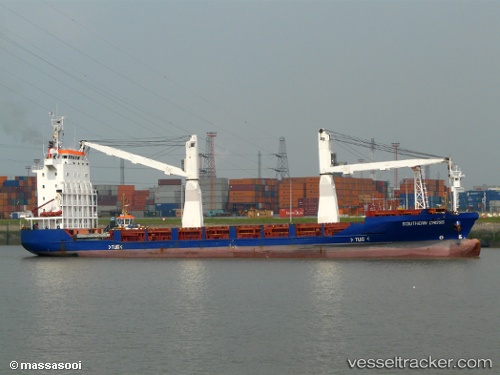
Vessel Meratus Project 1 IMO: 9197014, MMSI: 525025070 Multi Purpose Carrier
UTC, -4.82075, 136.84554, course: 129, speed: 0
UTC, -4.82072, 136.84554, course: 128, speed: 0
2026-01-15 06:58:26 UTC, -4.82074, 136.84550, course: 128, speed: 0
Live AIS position:
UTC. Near Pomako),
updated 2026-01-15 06:58:26 UTC.
Find the position of the vessel Meratus Project 1 on the map. The latter are known coordinates and path.
marine traffic ship tracker show on live map
The current position of vessel Meratus Project 1 is -4.82074 lat / 136.84550 lng. Updated: 2026-01-15 06:58:26 UTCDetails:
Last coordinates of the vessel:
UTC, -4.82075, 136.84554, course: 129, speed: 0UTC, -4.82075, 136.84554, course: 129, speed: 0
UTC, -4.82072, 136.84554, course: 128, speed: 0
2026-01-15 06:58:26 UTC, -4.82074, 136.84550, course: 128, speed: 0