 vesseltracker.com
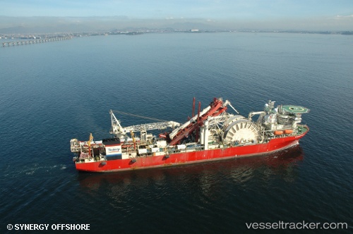
Vessel Deep Blue IMO: 9215359, MMSI: 311105000 Pipe Layer
UTC, -21.85437, -41.01076, course: 330, speed: 0
UTC, -21.85436, -41.01076, course: 330, speed: 0
2026-01-16 12:26:19 UTC, -21.85437, -41.01075, course: 330, speed: 0
Live AIS position:
UTC. Near PORTO DO ACU),
updated 2026-01-16 12:26:19 UTC.
Find the position of the vessel Deep Blue on the map. The latter are known coordinates and path.
marine traffic ship tracker show on live map
The current position of vessel Deep Blue is -21.85437 lat / -41.01075 lng. Updated: 2026-01-16 12:26:19 UTCCurrently sailing under the flag of Bahamas
Deep Blue built in 2001 year
Deadweight:
25449 tDetails:
Last coordinates of the vessel:
UTC, -21.85437, -41.01075, course: 330, speed: 0UTC, -21.85437, -41.01076, course: 330, speed: 0
UTC, -21.85436, -41.01076, course: 330, speed: 0
2026-01-16 12:26:19 UTC, -21.85437, -41.01075, course: 330, speed: 0