 vesseltracker.com
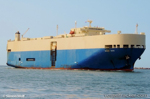
Vessel Grand Mark IMO: 9228306, MMSI: 355029000 Vehicles Carrier
UTC, 48.38528, -124.43483, course: 114, speed: 4.4
UTC, 48.35518, -124.33528, course: 117, speed: 11.2
2026-01-19 16:25:11 UTC, 48.32522, -124.24289, course: 114, speed: 12.3
Live AIS position:
UTC. Near Clallam Bay),
updated 2026-01-19 16:25:11 UTC.
Find the position of the vessel Grand Mark on the map. The latter are known coordinates and path.
marine traffic ship tracker show on live map
The current position of vessel Grand Mark is 48.32522 lat / -124.24289 lng. Updated: 2026-01-19 16:25:11 UTCCurrently sailing under the flag of Panama
Grand Mark built in 2000 year
Deadweight:
16681 tDetails:
Last coordinates of the vessel:
UTC, 48.41090, -124.51243, course: 115, speed: 4.3UTC, 48.38528, -124.43483, course: 114, speed: 4.4
UTC, 48.35518, -124.33528, course: 117, speed: 11.2
2026-01-19 16:25:11 UTC, 48.32522, -124.24289, course: 114, speed: 12.3