 vesseltracker.com
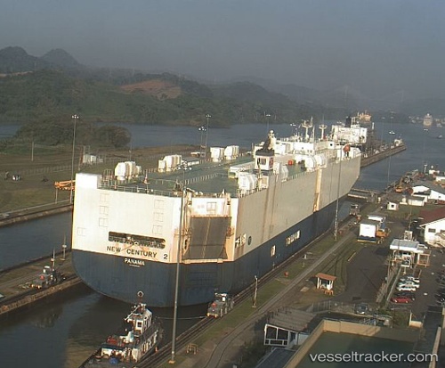
Vessel New Century 2 IMO: 9229403, MMSI: 636017294 Vehicles Carrier
UTC, 18.70488, 177.42032, course: 277, speed: 16.1
UTC, 18.73710, 177.19557, course: 277, speed: 16.2
2026-01-17 12:26:13 UTC, 18.74051, 177.17183, course: 275, speed: 16.1
Live AIS position:
UTC. Open sea (no nearby ports in database)),
updated 2026-01-17 12:26:13 UTC.
Find the position of the vessel New Century 2 on the map. The latter are known coordinates and path.
marine traffic ship tracker show on live map
The current position of vessel New Century 2 is 18.74051 lat / 177.17183 lng. Updated: 2026-01-17 12:26:13 UTCDetails:
Last coordinates of the vessel:
UTC, 18.66303, 177.91542, course: 271, speed: 16.1UTC, 18.70488, 177.42032, course: 277, speed: 16.1
UTC, 18.73710, 177.19557, course: 277, speed: 16.2
2026-01-17 12:26:13 UTC, 18.74051, 177.17183, course: 275, speed: 16.1