 vesseltracker.com
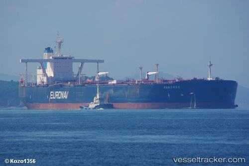
Vessel Sea Horizon IMO: 9233272, MMSI: 538006869 Crude Oil Tanker
UTC, 1.29037, 103.41637, course: 315, speed: 0
UTC, 1.29036, 103.41607, course: 318, speed: 0
2026-01-17 16:56:58 UTC, 1.28948, 103.41414, course: 358, speed: 0.3
Live AIS position:
UTC. Near TANJUNG PELEPAS),
updated 2026-01-17 16:56:58 UTC.
Find the position of the vessel Sea Horizon on the map. The latter are known coordinates and path.
marine traffic ship tracker show on live map
The current position of vessel Sea Horizon is 1.28948 lat / 103.41414 lng. Updated: 2026-01-17 16:56:58 UTCCurrently sailing under the flag of Marshall Is
Sea Horizon built in 2001 year
Deadweight:
298412 tDetails:
Last coordinates of the vessel:
UTC, 1.29046, 103.41643, course: 313, speed: 0UTC, 1.29037, 103.41637, course: 315, speed: 0
UTC, 1.29036, 103.41607, course: 318, speed: 0
2026-01-17 16:56:58 UTC, 1.28948, 103.41414, course: 358, speed: 0.3