 vesseltracker.com
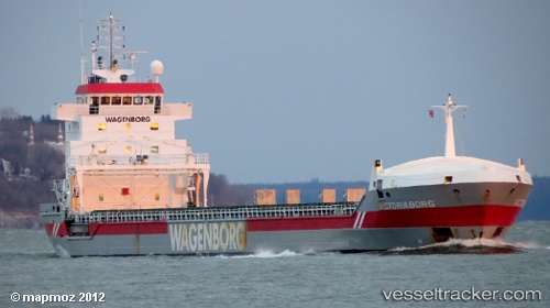
Vessel Victoriaborg IMO: 9234276, MMSI: 246029000 General Cargo Ship
UTC, 48.40500, -6.16500, course: -1, speed: 8
UTC, 48.11171, -6.41825, course: 209, speed: 9.4
2026-01-17 09:14:34 UTC, 47.62219, -6.82315, course: 204, speed: 9.6
Live AIS position:
UTC. 54 nm S of San Clodio),
updated 2026-01-17 09:14:34 UTC.
Find the position of the vessel Victoriaborg on the map. The latter are known coordinates and path.
marine traffic ship tracker show on live map
The current position of vessel Victoriaborg is 47.62219 lat / -6.82315 lng. Updated: 2026-01-17 09:14:34 UTCCurrently sailing under the flag of Netherlands
Victoriaborg built in 2001 year
Deadweight:
9850 tDetails:
Last coordinates of the vessel:
UTC, 48.41667, -6.15667, course: -1, speed: 8UTC, 48.40500, -6.16500, course: -1, speed: 8
UTC, 48.11171, -6.41825, course: 209, speed: 9.4
2026-01-17 09:14:34 UTC, 47.62219, -6.82315, course: 204, speed: 9.6