 vesseltracker.com
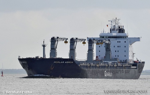
Vessel Poplar Arrow IMO: 9235141, MMSI: 311744000 Multi Purpose Carrier
UTC, -11.60737, -77.85198, course: 325, speed: 12.6
UTC, -11.54992, -77.89142, course: 327, speed: 12.7
2026-01-18 16:33:17 UTC, -11.35535, -78.01782, course: 329, speed: 12.7
Live AIS position:
UTC. 36 nm SW of Supe Bay),
updated 2026-01-18 16:33:17 UTC.
Find the position of the vessel Poplar Arrow on the map. The latter are known coordinates and path.
marine traffic ship tracker show on live map
The current position of vessel Poplar Arrow is -11.35535 lat / -78.01782 lng. Updated: 2026-01-18 16:33:17 UTCDetails:
Last coordinates of the vessel:
UTC, -11.87240, -77.68435, course: 329, speed: 12.7UTC, -11.60737, -77.85198, course: 325, speed: 12.6
UTC, -11.54992, -77.89142, course: 327, speed: 12.7
2026-01-18 16:33:17 UTC, -11.35535, -78.01782, course: 329, speed: 12.7