 vesseltracker.com
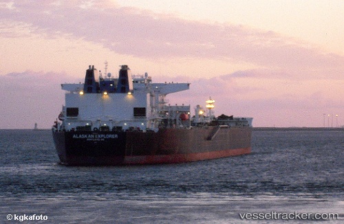
Vessel Alaskan Explorer IMO: 9244661, MMSI: 303294000 Crude Oil Tanker
UTC, 37.09112, -74.56674, course: 168, speed: 14
UTC, 36.79306, -74.53079, course: 176, speed: 14.3
2026-01-18 12:06:08 UTC, 36.26917, -74.50196, course: 178, speed: 14
Live AIS position:
UTC. 57 nm E of Nags Head),
updated 2026-01-18 12:06:08 UTC.
Find the position of the vessel Alaskan Explorer on the map. The latter are known coordinates and path.
marine traffic ship tracker show on live map
The current position of vessel Alaskan Explorer is 36.26917 lat / -74.50196 lng. Updated: 2026-01-18 12:06:08 UTCCurrently sailing under the flag of USA
Details:
Last coordinates of the vessel:
UTC, 37.39157, -74.52771, course: 173, speed: 13.6UTC, 37.09112, -74.56674, course: 168, speed: 14
UTC, 36.79306, -74.53079, course: 176, speed: 14.3
2026-01-18 12:06:08 UTC, 36.26917, -74.50196, course: 178, speed: 14