 vesseltracker.com
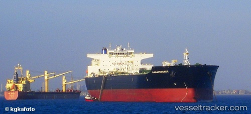
Vessel Alaskan Navigator IMO: 9244673, MMSI: 367688000 Crude Oil Tanker
UTC, 50.77517, -132.21788, course: 304, speed: 10
UTC, 50.81385, -132.31194, course: 304, speed: 9.9
2026-01-17 14:23:20 UTC, 51.01363, -132.71246, course: 313, speed: 9.6
Live AIS position:
UTC. 91 nm SW of Harriet Harbour),
updated 2026-01-17 14:23:20 UTC.
Find the position of the vessel Alaskan Navigator on the map. The latter are known coordinates and path.
marine traffic ship tracker show on live map
The current position of vessel Alaskan Navigator is 51.01363 lat / -132.71246 lng. Updated: 2026-01-17 14:23:20 UTCDetails:
Last coordinates of the vessel:
UTC, 50.68994, -132.00935, course: 306, speed: 10UTC, 50.77517, -132.21788, course: 304, speed: 10
UTC, 50.81385, -132.31194, course: 304, speed: 9.9
2026-01-17 14:23:20 UTC, 51.01363, -132.71246, course: 313, speed: 9.6