 vesseltracker.com
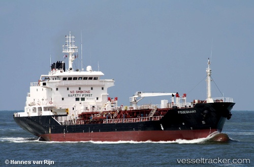
Vessel J M A IMO: 9246487, MMSI: 518998202 Oil Products Tanker
UTC, 25.84759, 56.92905, course: 358, speed: 0
UTC, 25.84759, 56.92926, course: 346, speed: 0
2026-01-15 09:30:18 UTC, 25.84765, 56.92938, course: 343, speed: 0
Live AIS position:
UTC. 38 nm E of Dibba),
updated 2026-01-15 09:30:18 UTC.
Find the position of the vessel J M A on the map. The latter are known coordinates and path.
marine traffic ship tracker show on live map
The current position of vessel J M A is 25.84765 lat / 56.92938 lng. Updated: 2026-01-15 09:30:18 UTCCurrently sailing under the flag of Cook islands
J M A built in 2001 year
Deadweight:
6902 tDetails:
Last coordinates of the vessel:
UTC, 25.84781, 56.92809, course: 59, speed: 0.2UTC, 25.84759, 56.92905, course: 358, speed: 0
UTC, 25.84759, 56.92926, course: 346, speed: 0
2026-01-15 09:30:18 UTC, 25.84765, 56.92938, course: 343, speed: 0