 vesseltracker.com
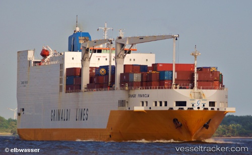
Vessel Grande Francia IMO: 9246592, MMSI: 247078800 Vehicles Carrier
UTC, 9.31272, -14.04179, course: 304, speed: 0
UTC, 9.31236, -14.04144, course: 315, speed: 0.1
2026-01-17 23:31:55 UTC, 9.31233, -14.04156, course: 296, speed: 0.2
Live AIS position:
UTC. 22 nm SW of Conakry),
updated 2026-01-17 23:31:55 UTC.
Find the position of the vessel Grande Francia on the map. The latter are known coordinates and path.
marine traffic ship tracker show on live map
The current position of vessel Grande Francia is 9.31233 lat / -14.04156 lng. Updated: 2026-01-17 23:31:55 UTCCurrently sailing under the flag of Italy
Grande Francia built in 2002 year
Deadweight:
26169 tDetails:
Last coordinates of the vessel:
UTC, 9.31375, -14.04148, course: 273, speed: 0.1UTC, 9.31272, -14.04179, course: 304, speed: 0
UTC, 9.31236, -14.04144, course: 315, speed: 0.1
2026-01-17 23:31:55 UTC, 9.31233, -14.04156, course: 296, speed: 0.2