 vesseltracker.com
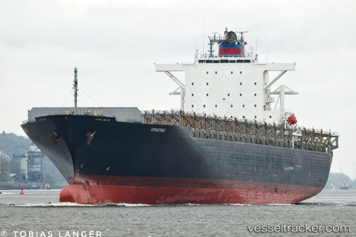
Vessel Venetiko IMO: 9260914, MMSI: 636015952 Container Ship
UTC, 22.75333, -86.63167, course: -1, speed: 17
UTC, 22.71632, -86.81578, course: 260, speed: 17.3
2026-01-18 23:20:31 UTC, 22.67833, -87.00167, course: -1, speed: 17
Live AIS position:
UTC. 87 nm N of ISLA MUJERES),
updated 2026-01-18 23:20:31 UTC.
Find the position of the vessel Venetiko on the map. The latter are known coordinates and path.
marine traffic ship tracker show on live map
The current position of vessel Venetiko is 22.67833 lat / -87.00167 lng. Updated: 2026-01-18 23:20:31 UTCCurrently sailing under the flag of Liberia
Venetiko built in 2003 year
Deadweight:
67009 tDetails:
Last coordinates of the vessel:
UTC, 22.85833, -86.19333, course: -1, speed: 18UTC, 22.75333, -86.63167, course: -1, speed: 17
UTC, 22.71632, -86.81578, course: 260, speed: 17.3
2026-01-18 23:20:31 UTC, 22.67833, -87.00167, course: -1, speed: 17