 vesseltracker.com
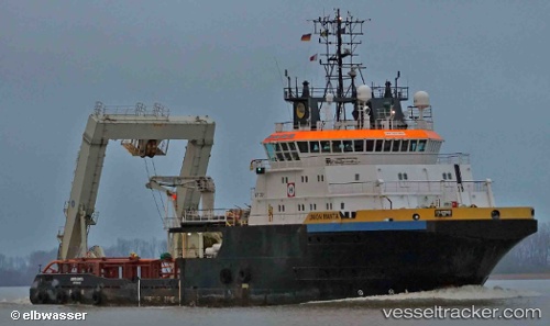
Vessel MANTA IMO: 9261487, MMSI: 205340000 Tug
UTC, 35.93547, 14.83194, course: 151, speed: 0
UTC, 35.93402, 14.83134, course: 91, speed: 0
2026-01-17 09:32:18 UTC, 35.93409, 14.83135, course: 76, speed: 0.1
Live AIS position:
UTC. 14 nm E of Il-Kappara),
updated 2026-01-17 09:32:18 UTC.
Find the position of the vessel MANTA on the map. The latter are known coordinates and path.
marine traffic ship tracker show on live map
The current position of vessel MANTA is 35.93409 lat / 14.83135 lng. Updated: 2026-01-17 09:32:18 UTCCurrently sailing under the flag of Belgium
MANTA built in 2003 year
Deadweight:
2444 tDetails:
Last coordinates of the vessel:
UTC, 35.93567, 14.83191, course: 164, speed: 0.1UTC, 35.93547, 14.83194, course: 151, speed: 0
UTC, 35.93402, 14.83134, course: 91, speed: 0
2026-01-17 09:32:18 UTC, 35.93409, 14.83135, course: 76, speed: 0.1